|
 State
- Assam, India State
- Assam, India
Capital
- Guwahati-Dispur
Population
-
26,638,40 (2001)
Population per
district (Top 5)
Kamrup
- pop. 2,522,234
Nagaon - pop.
2,314,629
Sonitpur - pop.
1,681,513
Barpeta - pop.
1,647,201
Dhubri - pop.
1,637,344
Earthquake History
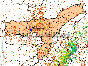
Much of Assam lies in the Bramaputra River Valley, except for a few
southern districts. The northern and eastern parts of this valley are
bounded by the Himalayan Frontal Thrust (HFF). In the eastern parts
along with the HFF, there is the are the Lohit and Naga Thrusts. Among
the large earthquakes in this region were the events in 1869 and 1897.
The 1897 earthquake is well known for the dramatic accounts of violent
upthrow during the shock.
Seismic Hazard
All districts of the state of
Assam lie in Zone V.
Since the earthquake database in India is still
incomplete, especially with regards to earthquakes prior to the historical
period (before 1800
A.D.), these zones offer a rough guide of the
earthquake hazard in any particular region and need to be regularly updated
(See also:
GSHAP Hazard Map for Assam).
Largest Instrumented
Earthquake in
Assam
12 June 1897 - Near Rangjoli,
Assam, M8.0
26.00N, 91.00E
This was one of the most powerful earthquake in the Indian sub-continent. The
quake wreaked havoc across a wide swathe of the present states of Assam and
Meghalaya. 1500 people were killed and hundreds more hurt. Damage from the
earthquake extended into Kolkata where dozens of buildings were
badly damaged or partially
collapsed. Shaking from the event was felt across India, as far as Ahmedabad and
Peshawar. Seiches were also observed in Myanmar.
Significant
Earthquakes in
Assam
The following list briefly outlines known earthquakes in this region. General locations are provided for historical events for
which "generalized" epicentral co-ordinates are available.
Some events which were significant for other reasons are also included.
This list will be updated whenever newer information is available. Please note
that Magnitude and Intensity are NOT THE SAME. All events are within the state
or union territory covered on this page unless stated otherwise.
Acronyms Used:
D=Depth,
OT=Origin
Time, Mw=Moment
Magnitude, Ms=Surface
Wave magnitude,
Mb=Body
Wave Magnitude, ML=Local
Magnitude, M?=Magnitude
Type unknown
|
This listing will be modified
without notice. Please check back for the latest version
when using it elsewhere.
Additionally, please
reproduce using appropriate
CITATIONS/CREDITS. |
10 January 1869 -
Cachar
(Assam), India, M 7.5
11:45 UTC, 25.00 N, 93.00 E
It caused serious damage in the region.
12 June 1897 -
Near Rangjoli, Assam, M8.0
26.00N, 91.00E
This was one of the most powerful earthquake in the Indian
sub-continent. The quake wreaked havoc across a wide swathe of the
present states of Assam and Meghalaya. 1500 people were killed and
hundreds more hurt. Damage from the earthquake extended into Kolkata
where dozens of buildings were badly
damaged or partially collapsed. Shaking from the
event was felt across India, as far as Ahmedabad and Peshawar.
Seiches were also observed in Myanmar.
21 January 1941 -
Near Tezpur, Assam, Ms 6.5
02:30:16.0 UTC, 26.50 N, 92.50 E
23 October 1943 -
Near
Nowgong, Assam, Mw 7.2
17:23:16.0 UTC, 23.00 N, 94.00 E
Felt strongly in the region and in neighbouring
Manipur. Not much is known about this earthquake as it occurred at
the height of World War II when the threat of Japanese aggression on
the eastern border of British India was extremely high.
15 August 1950
- Indo-China Border Region, Mw
8.6
19:39:28.5 IST/ 14:09:28.5 UTC, 28.70N 96.60E
This "Independence Day" earthquake was the 6th largest
earthquake of the 20th century. Though it
hit in a mountainous region along India's international border with
China, 1500 people were killed and the
drainage of the region was greatly
affected. The resultant floods were the cause of most of the
fatalities blamed on this earthquake. The initial shock was followed
by thousands of aftershocks, some of which were big earthquakes in
their own rights.
31 December 1984
- SSE of
Silchar, Assam, Mw 6.0
23:33:37 UTC, 24.64 N, 92.89 E
20 people were killed in Cachar District and a 100 were injured.
This quake was "forecast" on the basis of a seismic swarm which was
followed by a period of quiescence.
9 December 2004
-
Silchar region,
Assam, Mw 5.4
08:49:00 UTC, 24.710 N, 92.523 E
A
moderate earthquake struck the Silchar
region in Assam, India, on 9 December
2004 at 14:19 PM local time causing a few injuries and minor
damage to property. The earthquake
had a magnitude of Mw=5.4 and was felt in many
parts of north-east India and Bangladesh.
|